Methane & emissions monitoring
Satellite-based detection and quantification for oil & gas, landfills, and industrial sites using Sentinel-2, Sentinel-5P, open-source workflows, and machine learning.
Nicholas Kinsella · Geospatial & Earth Observation
Independent consultancy supporting developers, operators, regulators, and research teams — from satellite-based emissions monitoring to spatial analysis you can act on.

From the field & the lab
Services
Satellite-based detection and quantification for oil & gas, landfills, and industrial sites using Sentinel-2, Sentinel-5P, open-source workflows, and machine learning.
Spatial mapping, overlay analysis, environmental impact assessment, and constraint studies to support planning, permitting, and design decisions.
Workflow design, data processing, and technical support for organisations including the European Commission, landfill operators, and research groups.
PostgreSQL/PostGIS databases, GeoServer, OpenLayers, Python pipelines, and deliverables that integrate with your existing project environment.
Selected work
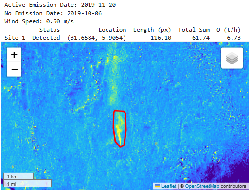
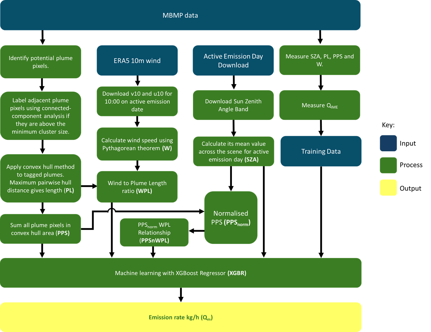
Open-source tool to detect and quantify methane super-emitting point sources from Sentinel-2 SWIR data using a processor-light XGBoost workflow. Designed to run on a modest laptop.
View on GitHub →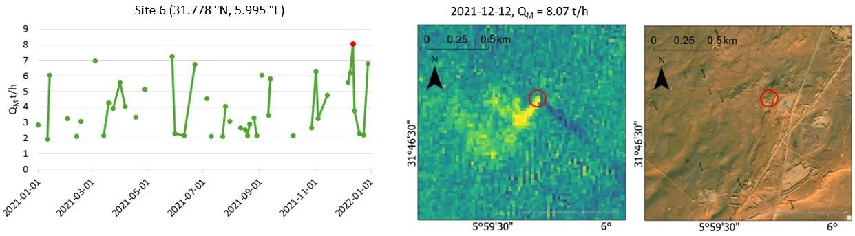
MSc research monitoring Algeria’s largest oil field (2021–2024) with CH₄ Sentinel and Integrated Methane Inversion. OSNI award winner; nominated for the RGS Outstanding Postgraduate Research prize.
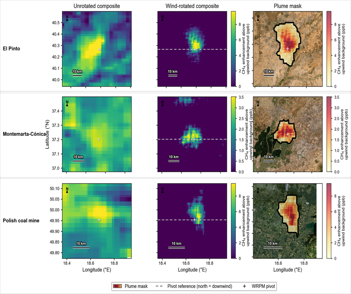
Read SPIE publication →Wind-rotated plume method using hundreds of daily Sentinel-5P passes to quantify landfill methane — including Spanish sites near Madrid and Seville, validated against independent airborne measurements.
Read the article →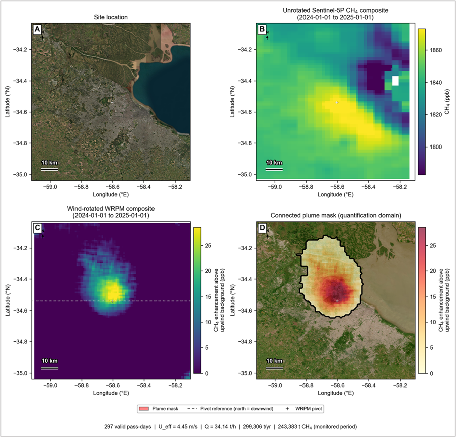
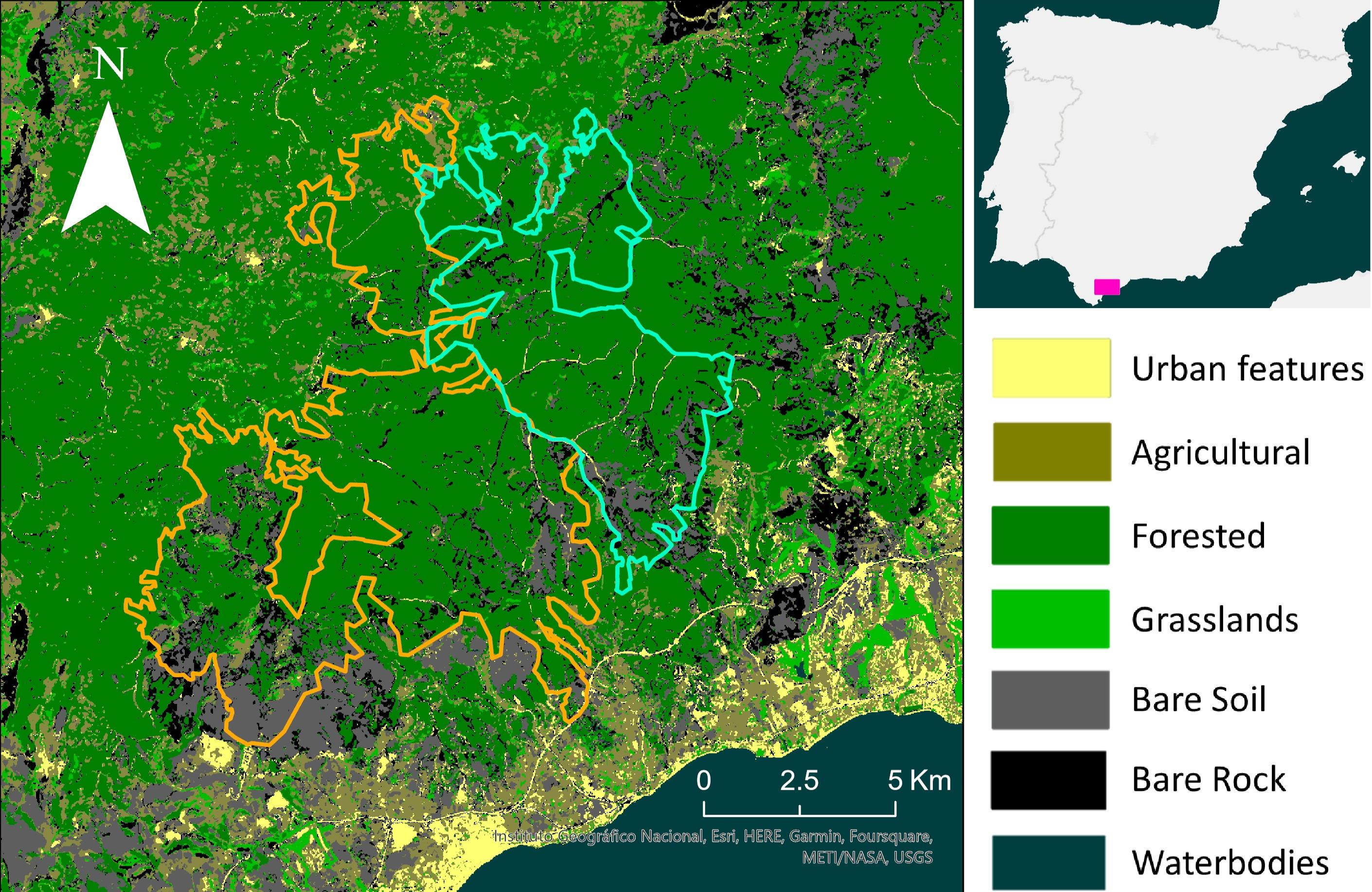
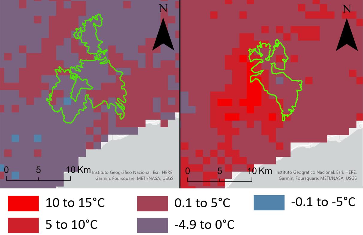
Forest fire risk assessment using LST and NDVI for two wildfire events in southern Spain, with land cover classification and temperature anomaly mapping.
Speaking
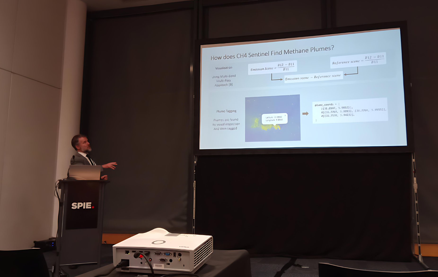
Presented CH₄ Sentinel and Hassi Messaoud methane findings at SPIE Sensors + Imaging 2025 in Glasgow, with further talks at GeoCymru and RSPSoc Wavelength.
Publication
Proceedings of SPIE, vol. 13671. Assesses Algeria’s progress toward its 2030 GHG reduction target using Sentinel-2 plume quantification and Sentinel-5P basin-scale inversion.
View publication → · Open-access thesis (PDF) →
About
I’m Nicholas Kinsella — a geospatial analyst and GIS project manager with a Distinction-level MSc in Geographical Information Systems from Ulster University and a background in geography from the University of Hertfordshire.
My work spans methane emissions monitoring, Earth observation, environmental GIS, and spatial data systems. I developed CH₄ Sentinel during my master’s research, presented findings at international conferences, and have delivered remote sensing analysis for the European Commission, landfill operators, and industry stakeholders.
I currently work as GIS Project Manager at Telespazio and take on independent consultancy engagements. I work in English and Spanish and am eligible to work in the UK and EU.
For project enquiries, scopes of work, collaborations, or an initial discussion about your site, dataset, or monitoring challenge.
consult@geokinsella.net